






Clarence Drive where the mountains meet the sea
A visual guide to one of South Africa’s most spectacular coastal drives: viewpoints, beaches, photography, a map and flexible itineraries.
Slow down. Every bend reveals a different coast.
Clarence Drive is the spectacular roughly 22-kilometre section of the R44 between Gordon’s Bay and Rooi-Els. Fynbos-covered mountains rise on one side, while cliffs and the waters of False Bay open out on the other.
Often included in extended Garden Route road trips, geographically it belongs to the Cape’s Whale Coast rather than the classic Garden Route proper. The natural continuation is via Pringle Bay, Betty’s Bay and Hermanus.

What to see along Clarence Drive
From the harbour to wild coast, with Pringle Bay as an optional extension. Stop durations are indicative and exclude driving time.
 01◷ 20–40 min
Gordon’s Bay
Before joining the R44, take in False Bay and the Hottentots Holland mountains. Start with broad establishing frames, harbour details and the contrast between town and nature.
 02◷ 10–20 min
Steenbras River mouth
Around Steenbras the first strong contrasts between rugged slopes, fynbos and sea appear. The scene changes quickly with every bend.
03◷ 15–30 minDappat se Gat
A locally known stretch of open coast and a beach tucked between rocky sections. Access can be steep and surf can be dangerous.
 04◷ 25–45 min
Kogel Bay / Kogelbaai
An extended sandy beach beneath the Kogelberg slopes, known for its dramatic mix of sand, coastline and mountains. Waves, wind and currents can be powerful.
 05◷ 30–60 min
Rooi-Els
The small settlement of Rooi-Els marks the usual end of the core Clarence Drive scenic stretch, with beach, river mouth, shorebirds and mountains.
 06◷ 35–60 min
Pringle Bay
Beyond the core drive, Pringle Bay adds an open sandy bay, scenic shore and a village for a break. It is a natural continuation towards Betty’s Bay.
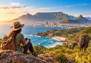
Images in this guide are original editorial visuals generated for this project; they illustrate the landscapes rather than document each exact location.
A coast to experience, not just drive through
Seven original editorial visuals to inspire your compositions. Open any image to view it larger.
Light
Early and late light often adds long shadows and texture. Check each viewpoint’s direction, cloud and haze.
Gear
A 16–35mm for wide scenes, 24–70mm for landscapes, and 70–200mm to isolate mountain layers or distant wildlife.
Stock video
Prioritise stable surf footage, fynbos details and static panoramas from designated pull-offs. Never film dangerously from road shoulders.
From the harbour to Rooi-Els, stop by stop
Markers show geographical references, not exact car-park entrances. Pringle Bay is an extension. Use Google Maps for actual driving directions and access details.
Loading map. You can also use the links on the right.
Indicative map without an exact road line. R44 access can change due to weather, roadworks or rockfalls.
How long should you allow for Clarence Drive?
Pick a suggested plan and adapt it to weather, light and your travel style.
For the main road with a couple of safe stops: pick two legal pull-offs and finish in Rooi-Els. This is only an indicative duration, never a guarantee.
View drive in Google Maps ↗Leave Gordon’s Bay and join the R44.
Short, safe viewpoint stop around Steenbras or Kogel Bay.
Arrive in Rooi-Els, with a short walk if time allows.
The best-balanced plan if you want to compose photographs and stop without rushing.
View drive in Google Maps ↗Gordon’s Bay: establishing images across False Bay.
Cliff section: one or two stops in designated pull-offs.
Kogel Bay: beach, fynbos and wide landscapes.
Rooi-Els: a relaxed finale by the river mouth.
A full day extending beyond the 22 km Clarence Drive section: add Pringle Bay, Betty’s Bay and Stony Point; continue to Hermanus if your schedule allows.
View drive in Google Maps ↗Early: R44 from Gordon’s Bay and legal scenic pull-offs.
Mid-morning: Kogel Bay and Rooi-Els.
Midday: Pringle Bay and a lunch break.
Afternoon: Betty’s Bay and Stony Point’s penguins.
Optional: continue towards Hermanus, depending on daylight and energy.
How to enjoy the drive safely
Road and parking
The R44 includes narrow bends and potential rockfall. Avoid unsafe roadside parking and only stop at designated pull-offs, obeying current signs.
Weather and closures
Past storms have caused major closures. Check official road status before setting out, especially after heavy rain.
Respect wildlife
Shorebirds, dolphins and seasonal whales may be visible; baboons can also occur in the region. Never feed wildlife or approach animals for a photograph.
Surf and paths
Surf can be very powerful and some beach accesses are steep. Check local notices and permits before walks such as Crystal Pools.
From Clarence Drive to penguins and whales
After Rooi-Els, continue through Pringle Bay and Betty’s Bay to Stony Point; with more time, drive onwards to Hermanus.
Sources & editorial transparency
The route and landmarks were cross-checked with local Cape tourism and geographical sources. The images are generated photographic recreations for this publication, not on-location documentary photographs or evidence of present conditions. Verify access, weather and road status before travel.