




Wilderness Where forest, lagoons and ocean meet
A guide to look beyond the road: memorable landscapes to visit, photograph and film, with realistic itineraries and light advice.
Slow down. Look closer. Make better photographs.
Between George and Knysna, Wilderness combines Indian Ocean beaches, lagoons, indigenous-forest trails and remarkably rich wetlands within a small area. It deserves more than a quick roadside stop.
The best plan mixes open coast with quiet water, forest and birds, rather than rushing every stop at midday. Times below are suggestions, not fixed opening hours.

Ten places worth stopping for in Wilderness
Filter by scenery, trails or wildlife. Every stop includes suggested time, photographic approach and a location link.
 35–60 min
The river bend shaped like Africa
The Kaaimans River loops around a forested hill resembling the African continent. The outline varies with perspective, water level and vegetation.
📷 Photo tip: Use a moderate wide angle at early or late light; fit the entire river bend into the frame.
 25–45 min
A signature coastal panorama
Coastal viewpoint overlooking the long beach and mountains, with possible distant dolphins. Check parking and safe access on arrival.
📷 Photo tip: Sunrise and a telephoto to compress surf and mountains; dolphin sightings are never guaranteed.
 45–90 min
Miles of sand and rolling surf
Expansive Indian Ocean beach for beach walks, wave photography and views of the Touw River mouth. Strong currents and breakers mean swimming is not safe everywhere.
📷 Photo tip: Footprints and reflections near low tide; long exposures with a tripod, well clear of the surf.
 45–90 min
Where lagoon meets ocean
The Touw River draws soft banks, reeds and reflections before meeting the ocean. The mouth shifts with rainfall and tides; use public access points and protect fragile banks.
📷 Photo tip: Calm dawn for reflections, low-angle reeds and clean video transitions.
 1–2 h
The heart of the national park
A SANParks base beside the Touw River amid forest and reedbeds. Canoe hire and activities depend on river safety, water conditions and post-flood reopening.
📷 Photo tip: Early light: river reflections, permitted canoeing and birds through a telephoto lens.
 3–4 h · if open
Forest, boardwalks and waterfall
The classic roughly 7 km return walk follows the river through indigenous forest to a waterfall. Flooding can close trails, pontoons or sections; check the official status BEFORE setting out.
📷 Photo tip: A polariser in the forest, tripod for silky water and moisture protection.
 45–90 min
Quiet channels, lakes and reflections
The Serpentine waterway connects the river system to Island Lake. Choose public viewpoints and launch only where SANParks permits.
📷 Photo tip: Mid-range focal length, first light and minimalist calm-water compositions.
 1–2 h
Birdwatching in wetland habitat
A bird hide overlooking Rondevlei wetland, rewarding for kingfishers, herons, birds of prey and waterfowl depending on season. Keep quiet and check boardwalk access.
📷 Photo tip: 300–600 mm telephoto, short bursts and patient observation.
 30–60 min
Rail bridge and dramatic gorge
River bends, greenery and a historic rail bridge. Shoot from lawful public viewpoints: railway lines, tunnels and closed walkways are not tourist access routes.
📷 Photo tip: Compress the gorge with a 70–200 mm lens for contrast between forest and structure.
 45–90 min
The giant of the Outeniqua forest
A remarkable yellowwood tree and short circular forest walk inland near Hoekwil. Check current access: flooding led to past closures.
📷 Photo tip: Low-angle wide composition; only include people with consent to convey scale, in soft light.
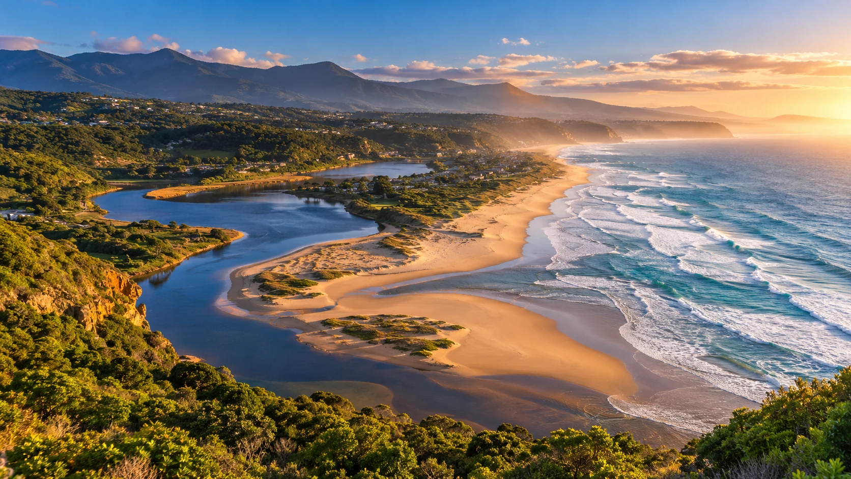
AI-generated gallery images are illustrative, not documentary. Verify exact locations and access locally; trail openings and times may change.
Light transforms Wilderness into a collection of scenes.
For versatile photo and stock-video coverage, combine horizontal panoramas, editorial verticals, close details and steady 10–20 second clips. Actual light depends on season, cloud and orientation.
Beach, river reflections and low-crowd scenes.
Ideal for forests, falls, ferns and close details.
Viewpoints, mountain layers and ocean silhouettes.
Long lenses and patience: never bait or approach nests.
For stock agencies: check visible logos, licence plates, recognisable people and any needed property/activity releases.
One day or two. No rushing.
Indicative times: adjust to your actual sunrise and sunset and verify access.
- 06:30Wilderness Beach↗
Sunrise, surf and reflections. Adapt the time to the actual sunrise on your date.
- 08:15Dolphin Point↗
Soft-light coastal panoramas and ocean watching.
- 09:30Map of Africa↗
River bend from above and wide scenic shots.
- 11:00Ebb-and-Flow · Touw River↗
Forest, a relaxed break and canoeing only if approved.
- 16:00Touw River & Lagoon↗
Reflections, reedbeds and late-day light.
- Day 1 · dawnWilderness Beach + Dolphin Point↗
Beach and lookouts ahead of harsh midday light.
- Day 1 · morningMap of Africa + Kaaimans↗
River panoramas, landscapes and mountain layers.
- Day 1 · afternoonTouw River + Ebb-and-Flow↗
Water, channels and forest. Check canoe and access conditions.
- Day 2 · morningKingfisher Trail↗
Waterfall trail ONLY if open; otherwise choose a confirmed open park walk.
- Day 2 · afternoonRondevlei + Island Lake↗
Birdlife, lakes and sunset from public viewpoints.
Where to stay, what to pack and how to travel responsibly
Where to stay
Wilderness Village for restaurants and beach; lagoon stays for dawn shoots; Ebb & Flow for a nature base. Book ahead in busy seasons.
Getting here
The N2 links Wilderness with George and Knysna. A car helps for viewpoints and wetlands; verify gravel-road conditions and never stop on unsafe shoulders.
Trail closures
Flooding has led to trail and activity closures. Check same-day SANParks updates before setting off for Kingfisher Trail or Woodville Big Tree.
Bird photography
Rondevlei and wetlands are rewarding for birdwatching. Never feed wildlife or use calls to force behaviour.
Ocean safety
The Indian Ocean can have powerful surf and rip currents. Follow local notices, stay off wave-washed rocks and avoid isolated beaches at night.
Suggested gear
16–35 mm for scenery; 70–200 mm for coast; 300 mm+ for birds; light tripod, polariser and rain protection. Drone use requires applicable permissions.
All the highlights on one map
Select a card or marker. Pin coordinates are indicative: use Google Maps links and check official access information.
A viewpoint over the Kaaimans River bend.
Google Maps ↗If the map fails to load, use the links on each card.
Wilderness is only the beginning of the Garden Route.
Continue to Knysna and Tsitsikamma, or explore our complete route from Mossel Bay to Gqeberha.
Sources, access & illustrations
Information checked against SANParks and mapping resources. Trails, services and activities can close because of flooding or conservation needs. New visuals are original digital illustrations and do not document exact real-world locations.